Photogrammetry is the science and technology of obtaining reliable information about physical objects and the environment through the process of recording, measuring and interpreting photographic images.
Photogrammetry uses methods from many disciplines, including optics and projective geometry. Digital image capturing and photogrammetric processing includes several well defined stages, which allow the generation of 2D or 3D digital models of the object as an end product.
By accurately geo referencing known locations within the images, we can very accurately map underwater ecosystems for later analysis. Capturing the same area over a set period of time allows us to measure environmental changes such as individual coral growth, seagrass bed changes or even rate of coral bleaching due to climate change.
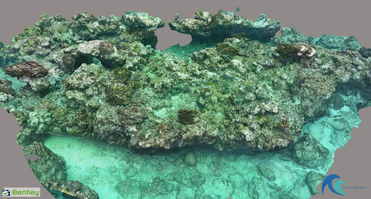
This is a 3D model created from over 4000 underwater images. The area within this model is approximately 30m long and 10m wide. Click on the image to open the 3D model and interact with it.
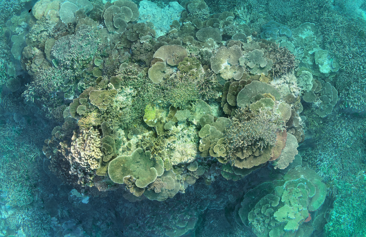
This image of a coral bommy is comprised of over 750 individual photos. The photos were stitched together to produce the overall image which covers an area of approx 10m long x 6m wide.